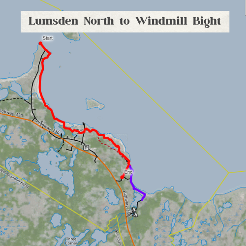
This 7.2 km coastal trail follows a mix of sandy beaches and ATV paths, making it a great option for hikers looking to experience Lumsden’s rugged shoreline. A longer 9.5 km alternate route crosses a shallow stream for those wanting a bit more adventure. Both routes are best enjoyed during the drier summer months, when navigating the marshes and berry patches is easier.
Along the way, you’ll find plenty of picture-perfect spots to tuck away for a traditional Newfoundland boil-up — because a well-earned cup of tea somehow tastes sweeter by the sea. Keep your eyes open for migratory birds, seabirds, and the occasional eagle, which are known to frequent the area.
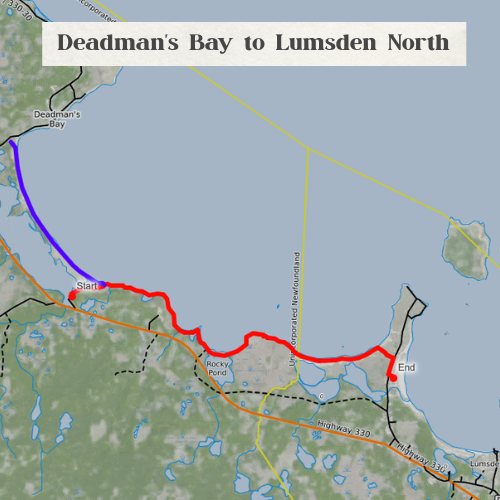
View the full trail map here: Deadman’s Bay to Lumsden Trail Map (CalTopo)